THE NORTHWEST, with its millions of acres of nearby wilderness, has always offered rich surcease to the hardy few determined to “get away from it all” and willing to put up with the countervailing inconveniences and discomforts of doing so. Thanks to technology, though, (think featherlight rainwear and tents, palatable freeze-dried provisions, and the like) the inconveniences and discomforts have dwindled to the point that outdoor adventure is no longer reserved for the hardy or the few—so much so that backpackers (never mind SUVers, motorbikers, and snowmobilers) may soon pose as big a threat to the environment as loggers.
In just the last year or so, technology’s impact has grown beyond improving on the traditional hiking-camping kit and into new areas of its own. Nowhere is this more noticeable than in the craze for electronic location and navigation devices. Northwesterners, boasting both appropriate terrain nearby and silicon sophistication, are pioneering once again as they did in the heroic age of local mountaineering between the two world wars.
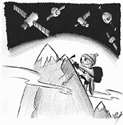
For such early adopters, May 2 was a red-letter day. On May 2, President Clinton instructed the Department of Defense to cease scrambling the signals broadcast by the Air Force’s network of Global Positioning System (GPS) satellites, so that civilians with a suitable receiver could make use of them to ascertain their location anywhere on the face of the earth to within an uncertainty of five to 10 feet. Since suitable receivers now cost little more than $100 and take up little more room than a PalmPilot, little wonder that GPS devices are becoming standard gear in the well-equipped backpack.
So lively is the market for GPS gadgets that manufacturers are racing to add bells and whistles to their models ahead of the competition. In addition to the backlit liquid-crystal screens showing your precise location (in any of half a dozen formats), many models also provide a satellite configuration display, a more or less accurate electronic compass, a serviceable altimeter, and programmable route planning and execution information. So complete are the services offered the outdoor navigator, in fact, that many people fail to regard the warnings and disclaimers that accompany them.
GPS DEVICES WORK by comparing endless identical, meticulously self-synchronized streams of digits broadcast by the system’s 24 satellites, at least four of which are always above the horizon anywhere on earth as they circle in their overlapping pole-to-pole orbits. Since your receiver “knows” that the signals it is picking up left the originating satellites at exactly the same time, it also knows that when it picks up the signal from Satellite B x microseconds later than the one from Satellite A, Satellite B is x-microseconds-times the-speed-of-light farther away. With signals from just three satellites, the receiver’s dedicated chip can calculate latitude and longitude position in a trice; with a fourth satellite in range, it can make a pretty good stab (within a hundred feet or so) at your altitude as well.
“In range”: There’s the catch. Like all low-intensity radio waves, GPS signals are easily obstructed, for example by tall trees beside a narrow trail or the steep rock walls of a gully. Bad weather is rarely a problem—GPS is at its most useful in the middle of a blinding blizzard—but buildings can be, and if you expect to use your receiver in your car, be sure to buy one that accommodates an external antenna.
There are other catches. Like batteries, for example. If you don’t have spares when you need them, your multitalented hiking companion is no help at all. In addition, GPS receivers are reasonably sturdy, but serious hiking can be a high-impact activity. Your receiver is safe enough wrapped in a spare pair of long johns in your pack, but it’s not much use to you as long as it’s there.
How much use is it even when it’s working and in-hand? That depends on the conditions in which you’re likely to be using it. Crossing the Gobi Desert or the Antarctic Icecap, where landmarks and obstructions are few and far between, navigation by GPS is far and away the best option. At the other extreme—and the best hiking in the Northwest is generally at the opposite extreme—GPS information is of dubious assistance. Knowing to the yard exactly where on earth you are isn’t much use when your immediate problem is figuring out a way across a devil’s club-choked gully when you’re already waist-deep in slippery salal and slide alder.
But the real downside of owning a GPS system is more subtle. Read the brochure in the box your unit came in—and be honest now, how many of us do?—and you’re sure to find a clear and plainly stated warning: Mere ownership of a GPS is not a substitute for possessing the basic skills of traditional outdoors survival. With a map and a compass and the ability to use them under real field conditions, a GPS receiver can be a great accessory; without them it’s an invitation to disaster.
And to make the most of your new outdoor accessory, you must be prepared to do more than skim the brochure. Most of the information available to the user is heavily compressed to cram as much of it as possible onto the unit’s tiny screen, and you’ll need to spend many hours practicing and poring over the manual before you’ll be able to get much practical use out of it. The most powerful and valuable service GPS devices offer—the ability to break a long off-trail wilderness trek down into a sequence of “waypoints”—demands that you know how to program the gadget’s built-in computer, plus lots of prep work with map, protractor, and straightedge.
THIS WILL NOT always be the case, of course. Already on the market are software programs that claim to make wilderness route planning a breeze. Some—notably the Topo! series of “interactive maps” of national parks and wilderness areas published on CD-ROM in collaboration with National Geographic—deliver on much of their promise, allowing users to transfer data directly from hard disk to GPS without manual programming or paper map intermediary. But unless you’re planning to go hiking with a pretty sophisticated laptop, you’ll still need paper maps anyway, so why not get familiar with their version of the terrain before you need to—in a sleet storm on a 45-degree talus slope at nightfall?
All the computerized map programs draw on the same basic data: the nation-spanning topographic map archive assembled over the last century by the US Geological Survey. But they differ widely in the way they display said data. Perhaps the most delightful such application is the one with the least obvious practical justification: the 3-D machine that the programmers at the Delorme Corporation of Yarmouth, Maine, put to work in their 3-D Topo Quads series. Pick a patch of map terrain that intrigues you and press the 3-D button. Rotate the landscape through 360 degrees, change the viewing angle from precipitous to tree-skimming, pump up the vertical scale from a realistic one-to-one to eight-to-one and watch a placid landscape turn to the mountains of the moon.
Not that Delorme products don’t have a practical side. New this summer is their patented Earthmate navigation system, which the company says will turn your laptop or PalmPilot into a sophisticated GPS companion device to Delorme software products such as Street Atlas USA and Eartha Global Explorer. Can the day be far off when such services will be offered on your cell phone?
In the meantime, learn to use that compass. . . .
Links:
For an overview of the history and theory of GPS:
http://www.colorado.edu/geography/gcraft/notes/gps/gps_f.html
For Topo! products:
http://www.topo.com/products/index.html
For Delorme’s Earthmate product: