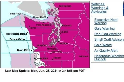
Additional oppressive heat blistered the Pacific Northwest on Monday (June 28) before the core of the unprecedented heat shifts into interior sections of the region on Tuesday and Wednesday, according to the National Weather Service.
The NWS forecasts high temperatures of 30 or more degrees above average throughout Washington and north-central Oregon to start the work week, with temperatures peaking in the 100s and 110s.
Numerous daily, monthly, and all-time temperature records are forecast on top of the records that went up in flames this weekend with high temperatures of 104 on Sunday (June 27) and 112 degrees forecast on Monday (June 28), according to the NWS.
This level of heat is dangerous and can be deadly if proper heat safety is not followed. So the NWS urges residents stay in air-conditioned buildings, avoid strenuous outdoor activities, drink plenty of water, and check on family members, neighbors and pets.
Cooler temperatures associated with a cold front and onshore winds are forecast to enter areas west of the Cascades by Tuesday (June 29), but extreme heat will remain and build farther inland across the Northern Great Basin this week. Additional high temperature records are a guarantee for interior sections of Washington and Oregon over the next few days, extending into most of Idaho and western Montana on Tuesday.