The Super Flood
Published 7:00 am Monday, October 9, 2006

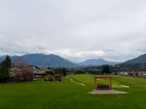
Some 5,600 years ago, the body of water we call Puget Sound had an arm that extended 30 miles inland from present-day Elliott Bay in Seattle to a point halfway between Auburn and Sumner. Today, of course, that is the Green River Valley—the narrow, flat suburban land of Kent and Renton and the industrial lowlands of South Seattle. It would be reasonable to think that this change happened gradually, but scientists have determined that most of the long-gone stretch of inland sea was transformed by a single event that created 200 square miles of land in a matter of hours, with waves of mud 20 feet to 600 feet high. Imagine a wall the consistency of wet concrete traveling up to 60 mph. This mudflow destroyed everything in its path, uprooting entire old-growth forests. It hit Puget Sound with such force and with so much material that it flowed underwater for 15 miles, maybe farther. An area of hundreds of square miles was covered with mud and debris up to 350 feet deep.
The source of that enormous mudflow, which geologists call a lahar, was Mount Rainier, about 60 miles south- southeast of Seattle. And it could happen again—maybe even tomorrow. The U.S. Geological Survey estimates there is at least a 1-in-7 chance during an average human lifespan that another catastrophic lahar could pour off the mountain. Little if any eruption would be needed to trigger it. There would be little warning near the mountain, and farther away, the most fortunate residents might have up to an hour to flee.
Mount Rainier is potentially one of the most lethal volcanoes in the world. The United Nations has designated it as one of 14 mountains that could cause catastrophic devastation. The U.S. Geological Survey calls Rainier this country’s most dangerous volcano. The explosive potential of a 14,411-foot mountain with a history of 40 ash-producing eruptions since the Ice Age should not be underestimated. But scientists agree that far more menacing, and potentially far more deadly, is the scenario of a lahar burying a large part of suburban Seattle. Under some scenarios, the city itself is vulnerable. Officials have made plans to evacuate areas near the mountain, if there’s enough warning, but some emergency planners—and housing development regulations, for that matter—regard Mount Rainier as a threat far away.
In the 1950s, Rocky Crandell was a young USGS geologist just out of graduate school when he was assigned to map the area east of Tacoma. He could find none of the glacial till—the dirt, gravel, and rocks that glaciers leave behind—that he expected in the valleys below Mount Rainier. Instead, he found mud deposits—evidence, he theorized, of a massive flood. But where the flood came from and what caused it were a mystery. “I could see Mount Rainier in the distance, but I didn’t make the connection for a long time,” Crandell said later.
It was 10,000 feet up on the slopes of Rainier that he found his answer. Samples Crandell took there were the same material he had discovered in the lowlands. The flood below could only have resulted from a massive landslide on Rainier. However, he found no evidence of the huge eruption that he thought would be needed to cause such a landslide. Crandell would go on to forecast the 1980 Mount St. Helens eruption—five years before it happened—and become a legend among geologists. But the mystery on Mount Rainier remained.
As Crandell and others pieced together the Mount Rainier event, what they discovered stunned them: Whatever the cause, the landslide had triggered the greatest flood of mud and debris that man has ever known, and it meant that metropolitan Puget Sound was at risk for another catastrophe, one that would dwarf this year’s Hurricane Katrina in human toll and perhaps even surpass the Southeast Asian tsunami of 2004, which took more than 200,000 lives.

Areas that could be affected by an enormous debris avalanche and associated lahars similar in magnitude to the Osceola Mudflow 5,600 years ago. (Based on research by R.P. Hoblitt, J.S. Walder, C.L. Driedger, K.M. Scott, P.T. Pringle, and J.W. Vallance for the U.S. Geological Survey.) |
It took years to map the lahar that Crandell discovered and to realize its full magnitude. When he and his colleagues finished, the scientist named the monster lahar the Osceola Mudflow, after the tiny valley hamlet near Enumclaw where he had found his best samples. Using radiocarbon dating, scientists were able to put the age of those deposits at 5,600 years, hardly a blink of an eye for 700,000-year-old Rainier. And the cause of this cataclysmic event had not been a massive eruption. It had been a very small eruption, and some scientists thought it had not been an eruption at all but only the movement of magma within the mountain. All agreed, however, about what had happened next. The top 2,000 feet of the mountain slid off and almost instantly was transformed into the Osceola Mudflow.
The 1980 eruption of Mount St. Helens vividly demonstrated not only a volcano’s explosive power but also its potential to create lethal lahars. The lahars that swept down from Mount St. Helens were so powerful, they picked up entire logging camps—buildings, cranes, trucks, buses, and even trains with flatbed cars loaded with logs. A catastrophic flood followed the lahar’s path and flowed into the Cowlitz River. It cascaded into the mighty Columbia River and unleashed a 20-mile-long logjam, with debris floating to the Pacific Ocean. The Columbia, approximately 60 miles from Mount St. Helens—about the same distance Seattle is from Mount Rainier—was closed to shipping for a long period, at a cost of millions of dollars.
Then, in 1985, the Nevado del Ruiz volcano in Colombia erupted with a blast only one-sixth that of the Mount St. Helens eruption. It was a small event but had horrific consequences. In less than two hours, a lahar swept into Armero, the city below the mountain. Four thousand buildings were destroyed, and 21,000 people lay dead or dying.
The Mount St. Helens lahar and even the Nevado del Ruiz lahar are minuscule compared to most of the 60 major lahars that scientists now know have surged over the millennia from Mount Rainier. In studying them, scientists found conclusive evidence that many lahars—including Rainier’s second largest but still one of the greatest ever recorded, the Electron Mudflow—didn’t coincide with any eruptions involving magma. Mount Rainier was a virtual factory of landslides. Lahars could come at any time, even, according to the USGS, after a landslide caused by a regional earthquake 60 miles away on the Seattle fault.

Frank Parchman is the author of Echoes of Fury: The 1980 Eruption of Mount St. Helens and the Lives It Changed Forever. He has won more than 75 national and regional writing and journalism awards and lives in Redmond. |
There is more snow and ice in the glaciers of Mount Rainier than all the other 12 Cascade Mountain volcanoes put together. “It’s almost like a positive feedback system,” says Pat Pringle, a geology teacher at Centralia College and a geologist formerly with the USGS and the state Department of Natural Resources. Pringle, who has spent most of his career studying Rainier’s lahars, is considered by many geologists to be one of the top experts in his field. The glaciers, Pringle says, are carving away at the mountain’s flanks, creating unstable steep slopes while contributing to groundwater that comes in contact with heat and sulfur. The acidic liquid that results helps weaken rock, resulting in landslides of claylike material that has a high water content. This porous material becomes a lahar that behaves and looks like wet concrete. Of course, lahars could also result from volcanic activity.
In 1995, four of the top lahar scientists in the country, including Pringle, wrote a USGS paper on the Osceola Mudflow. “The inundation area of a modern cohesive lahar of the same size could extend to Puget Sound, through Tacoma along the Puyallup River and through Seattle by way of the Green River system and the Duwamish Waterway,” they wrote. “The lower resistance to flow of the modern unforested river valleys would allow a recurrence of this flow to go farther and faster than the original. . . . ” Scientists now understood that giant lahars could come without warning and destroy much of the Puget Sound region “within a matter of hours,” according to Don Swanson of the USGS, considered to be one of the world’s elite volcanologists.
Because of the enormous size and complexity of the Osceola Mudflow, scientists are reluctant to estimate how much larger a modern-day flood on the same scale would be. There are differences that suggest it could be bigger. Besides fewer forests, an Osceola-size flood today would not encounter the vast arm of water that extended 30 miles inland from where the Port of Seattle is now. It would be much easier for a lahar to travel over this land, and that means Seattle could feel the brunt of a same-size event today. The experts who penned the USGS paper and many other scientists agree that a lahar disaster on the scale of the Osceola, with the potential of almost unimaginable destruction, should be included in government hazard plans.
The extent of a lahar threat to Pierce County and Tacoma has been known for a while. But the peril lahars hold for Seattle is a relatively recent discovery. It wasn’t until 1996 that geologists digging at the Port of Seattle’s Terminal 107 on the Duwamish Waterway made a startling discovery. They found a layer of sand they recognized could only have come from Mount Rainier. They had already found similar sand near the Emerald Downs racetrack in Auburn and beneath the Puyallup Fairgrounds. “We were amazed, just amazed,” Pringle says.
The sand came from a relatively small lahar compared to the Osceola but one big enough that its deposits apparently filled the lower Duwamish Valley from wall to wall, all the way to Elliott Bay. This flood of mud and debris occurred only about 1,200 years ago.
This discovery and others like it since have dire implications for Seattle and the region. Even a lahar much smaller than the Osceola could have catastrophic effects on Seattle, Tacoma, and the suburbs. Geoff Clayton, a geologist with one of the pre-eminent engineering firms in the state, RH2, was asked by Seattle Weekly to evaluate the potential impact of a lahar on Seattle. Using a software program that analyzed present topography, he concluded that “a mudflow from Mount Rainier is the most catastrophic natural disaster that could happen to this area.” Before approaching Seattle, a lahar, he says, would have “wiped out Enumclaw, Kent, Auburn, and most of Renton, if not all of it.”
Clayton and other geologists agree that a lahar could spawn tsunamis on Puget Sound and Lake Washington, though Clayton cautions such a prediction is very speculative. Seattle could be inundated on both sides. The lahar’s flows would follow the tsunamis, displacing additional water to flood the city. The Port of Seattle would be buried.
The region could be impacted for decades by secondary flooding from breached lakes and silt-filled rivers, according to Pringle. Some officials think the Mud Mountain Dam on the White River would protect the area downstream from a lahar. But Pringle says the dam might be no match, and even if the structure held, the flow could overtop it.

An artist’s conception of how the giant landslide of the Osceola Mudflow might have begun 5,600 years ago. See a video of this and the resulting lahar (MPEG video – 1.6 megabytes). (Jose Vigil / U.S. Geological Survey) |
After the terminal 107 discovery, the USGS issued new hazard maps that showed that even a relatively small lahar could inundate Seattle’s waterfront and parts of downtown. Seattle’s hazard mitigation plan says about disasters in general, “Many parts of Seattle are in danger of being cut off from emergency services due to geological barriers and the centralization of services and businesses. Many government services and businesses are located in or near the downtown.” A lahar reaching even part of downtown would have an impact on the entire city. But the word apparently has not reached city officials, who have made no provisions for lahars in their hazard planning. Barb Graff, Seattle’s director of emergency management, who has been on the job just four months, is only “vaguely aware of the Osceola” and is at a loss to explain why the city has made no plans for a potential lahar disaster, in light of the Terminal 107 discovery and the new USGS hazard maps. She hopes that the city’s one-size-fits-all disaster response plan could cover any contingency.
It is only in the past year that King County has recognized that lahars hold any threat. Evacuation routes are being planned for residents in the south county. However, the county practices government flimflam in the extreme when it comes to restricting development in known lahar paths. Says a document for “volcanic hazard areas”: “No critical facilities, apartments, townhouses, or commercial structures shall be allowed; and all new lots created by subdivision, short subdivision, or binding site plan shall designate building areas and building setbacks outside of the volcanic hazard areas; and notice of critical areas is required for new single detached dwellings on existing lots.” The volcano hazards section then ends with this startling statement: “Effectively, all alterations are allowed without meeting any of the above development standards because the volcanic hazard areas restrictions are not yet in effect. King County has no current plans to complete the required volcanic hazard mapping.”
Pierce County has done an excellent job preparing for a lahar in the multitude of published planning documents devoted entirely to volcano hazards. Those plans mince no words in describing the coming catastrophe. “It is virtually certain . . . that lahars, either eruption-related or not, will inundate valley floor areas that are now densely populated, causing severe social and economic impacts,” says the county’s Mount Rainier Volcanic Hazards Response Plan.
The only problem is that Pierce County has done planning with a nod and a wink. It has provided citizens with detailed maps of evacuation routes that experts, off-the- record, admit have little chance of helping save very many people. While pouring considerable money into lahar hazard planning, Pierce County has allowed development of thousands of new homes in the very shadow of Mount Rainier, right in the volcano’s most dangerous lahar paths. Often only two-lane roads serve these new subdivisions and many older ones. People trying to escape a fast-moving lahar in the chaos and traffic would have little hope of survival. Pierce County has a population of approximately 700,000 people, according to the 1999 volcano-hazards document. Officials estimate that 200,000, including day workers from outside the county, inhabit the most critical path threatened by a lahar.

Mount Rainier and new housing in Orting, which will be ground zero when the mountain generates another catastrophic lahar. (David Wieprecht / U.S. Geological Survey) |
The small town of Orting, one of the population centers of significant size closest to Mount Rainier, is emblematic of growth and its consequences in the volcano’s most critical lahar path. Orting is less than 30 miles from the volcano, at the confluence of the Puyallup and Carbon rivers. Many of Rainier’s known major lahars passed over the very land upon which the town is built. Driving into town, it seems new subdivisions are sprouting everywhere, with new schools to support them. In the past 15 years, the town has nearly doubled in size and plans to almost double again in a few years, to a population of 7,000. Other parts of Pierce County in the critical lahar path have seen similar growth.
A few years ago, the USGS gave Pierce County a state-of-the-art lahar warning system comprised of a network of monitoring stations that automatically activate warning lights in Pierce County’s 911 center and at the Washington State Emergency Operations Center at Camp Murray. Under drill conditions, it only takes three minutes to activate evacuation sirens, according to Jody Woodcock, program manager for mitigation and preparedness for Pierce County’s Department of Emergency Management. In reality, “there has to be a series of events that happen before the lahar warning system is triggered,” she says when asked about the potential for false alarms. The sirens have gone off accidentally six times since 2002. Some of those times have been because of operator error and others because of malfunctions, for which officials still have found no cause. The system has stations scattered along the slopes of the upper Carbon and Puyallup river valleys. The sensor closest to the valley floor in each location is what is called “the dead-man site” and is one of two sites that must be destroyed before activating the warning system. A lahar beginning near the peak of the mountain could have traveled some distance before hitting this site. Then there is the question of equipment malfunction and potential confusion. “If the 911 center saw a site go down and the state Emergency Operations Center had some warnings going off but they didn’t have any sites going down, they would not trigger the alarm,” Woodcock says. “Both parties have to see the exact same thing for it to be triggered.”
The travel time for a large lahar from Rainier to Orting could be as little as 30 minutes, according to the USGS. In a recent computerized mock drill using a warning time of 45 minutes, Orting could only make its evacuation plan work by having people drive on the one road heading in the direction of the lahar.
Moreover, it is doubtful that a majority of residents in the path of a lahar would even recognize what evacuation sirens meant. Pierce County officials have found a surprising lack “of knowledge on the hazards that the mountain represents to the communities that surround it. There was and is a strong assumption by people that the mountain is ‘extinct,’ or at worse ‘dormant,'” according to the volcanic hazards plan. The Pierce County Natural Hazard Mitigation Plan makes it plain what the consequences for Orting could be in the event of a lahar: “In those areas with deeper mud, such as Orting, the original town would never be uncovered.”
The unabated construction of thousands of new homes in known lahar paths leaves Pringle “flabbergasted. It doesn’t take a brain surgeon to know what is going to happen in the future. But a geologist can only be an advocate for taking information seriously. We can’t step out of our role and ask, ‘Why don’t you get out of harm’s way?’ because it is not what we are tasked to do.”
As the clock ticks, the probability of a giant killer lahar is increasing. In Mount Rainier: Learning to Live With Risk, the USGS says there is at least a 1-in-7 chance of such a lahar occurring during an average human life span. As for a flood on the scale of the Osceola, characterized by scientists as “low probability and high consequences,” USGS volcanologist Swanson does not discount a reprise. “Anything that has happened in the past can happen again, unless the source area has so drastically changed, and clearly that is not the case here.”