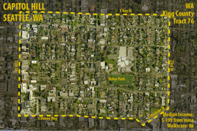
Huh. Well, according to whatever the hell is going on above—apparently Capitol Hill is the best place to live in the U.S. An urban planner named Dave Munson from D.C deduced this from a very knotty math equation he created.
Based on a bajillion variables, Munson ranked every single place in the country to determine which areas were the most walkable and affordable. Capitol Hill earned the highest score, which may surprise people on Capitol Hill, who I don’t often hear talking about how affordable the neighborhood is.
I’ll let Munson explain his math though:
Using census data, I decided to map the variables of affordability and walkability. Affordability wasn’t hard; I mapped all the census tracts in the country that had a median income within $10,000 of mine, both above and below.This shows me where I can afford to live, but a lot of the areas are rural places that I would never want to live in. My next task was to map walkability.Walkability was harder to map. Even though Walkscore covers everywhere in America, it only offers it’s data in downloadable form for Washington, DC. So I downloaded the data, calculated the average Walkscore for census tracts in DC, downloaded virtually the entire American Community Survey, and compared the data therein to the average Walkscore to look for correlation.
I found nineteen variables that had some significant correlation with Walkscore. I took each of these variables and gave them a score of one or zero, one if Walkscore would be above 70 at the value, or a zero if it would be below. Then I multiplied that score by each variables’ R-Square value, and added all the variables together to get a weighted Walkability score. I eliminated the bottom 50% of these values, and added the remainder to the map.