14.1 Inches And Counting: Record-Breaking Snow Pounds King County
Published 1:00 pm Monday, February 11, 2019


Snow and freezing temperatures battered King County last week, making this the snowiest February on record.
The downfall began Feb. 2 in a first storm that led to snow closures, only to melt off enough for roads to clear in the following days. However, it began to fall again Feb. 8 and has been hailed as a “snowmageddon,” again shutting down cities across the region and sparking runs on supermarkets.
As of Monday morning, National Weather Service meteorologist Jeff Michalski said there had been around 14.1 inches of snow in SeaTac where measurements are taken, making it the snowiest February on record and one of the most intense in recent memory.
“It’s definitely our biggest system I guess in the last seven years,” he said.
Other storms in 2008 and 2012 brought significant snow to the region, which typically sees under an inch annually. Temperatures were expected to rise on Monday afternoon, leading to rain over the following days and a gradual melting. Michalski said there will likely be snow on the ground for the remainder of the week and no massive melt-off is expected, making flooding in eastern King County unlikely.
While King County may be thawing out thanks to warmer southwest air blowing in off the Pacific Ocean, areas farther north are expected to see more snow as frigid air continues to funnel down from Canada. These competing air currents have made it difficult to predict snowfall over the past week.
“We have kind of competing air masses at hand,” Michalski said. “This has been a really challenging forecast trying to nail down snowcast totals.”
Another storm system is on its way and expected to hit Thursday night and Friday, but Michalski said warm temperatures mean the precipitation will likely remain as rain. These winter storms were caused by a ridge that King County had been under for most of the winter, moving farther out to sea and to the north, reaching Alaska. As the ridge moved, it allowed cold air from Canada to cascade into the U.S.
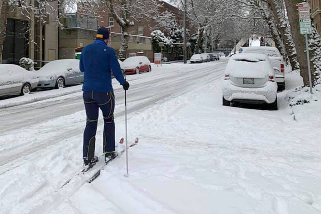
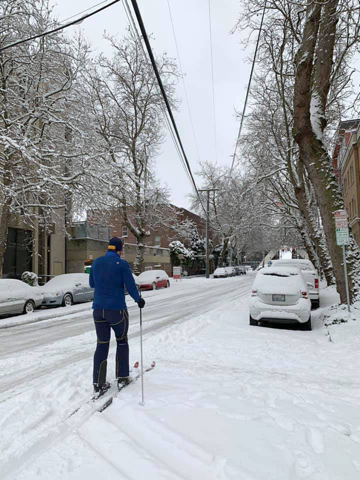
With people snowed-in this past Saturday, many found ways to ride out the storm — such as sledding down closed streets or hosting a snow-day dance party in Capitol Hill’s Cal Anderson Park. The county has also made additional shelter space available in Seattle for those experiencing homelessness.
The most recent storm has been called Winter Storm Nadia and is expected to work its way across much of the U.S., according to The Weather Channel. The Cascades are expected to see up to 3 feet of snow including over Snoqualmie Pass. Later in the week, after the storm passes through the Pacific Northwest, it could end up in the Midwest, bringing snow to Chicago and Detroit.
In response to the snow, the Seattle Department of Transportation has been working to clear major arterial roads, which can be seen on the city’s winter weather response map. Road crews coat city streets with anti-icing agents before a snowstorm and work around the clock to keep roads plowed and clear.
The city had around 35 plows and some 15 sidewalk maintenance crews around the city as city officials urged residents to stay home or take public transit. During the storm, the state Department of Transportation had around 100 plows and trucks clearing Interstate 5 between Canada and King County.