The decision with the most potential to change the face of Seattle isn’t Sound Transit or the monorail. It’s not the Alaskan Way Viaduct. It isn’t even on the ballot. The decision that could most radically change the way Seattle looks and feels 20 years from now is: When the viaduct comes down, what happens to the central waterfront? The answer will have ramifications from South Lake Union to West Seattle and could fundamentally alter the way Seattle is perceived.
It took a massive earthquake to jostle them into gear, but city planners have finally gotten serious about rebuilding and burying the threatened Alaskan Way Viaduct, which stands a one-in-20 chance of suffering catastrophic damage in the next 10 years. The prospect has raised some long-dormant questions: What is the future of Seattle’s waterfront? And will tearing down the viaduct— noise-producer, grit-emitter, and eyesore that it is—turn the waterfront into a place where even native Seattleites will want to be? Or is the waterfront doomed to be a noisy, candy-colored tourist trap, a lollipop with a hollow center?
You can throw a rock a long way in Seattle without hitting a native who likes spending time down on the central waterfront. Sure, there are times when we’re all tourists in our own city—the family heads over from Montana, and we make a beeline for the trinket shops—but for the most part, Seattle’s central waterfront is more the city’s overgrown backyard than its carefully tended garden. We don’t open the fence very often, because we’d rather not take a look at what’s back there.
Walking along the city’s central waterfront, starting at the sea of concrete and automobile exhaust of the Washington State Ferry Terminal, the first thing you notice is the noise. Just being heard over the roar of auto traffic 60 feet overhead becomes a major vocal challenge, and talking in a normal voice is out of the question. The second thing you notice is that, unless you’re in the market for a boat in a bottle or a basket of fish and chips, there isn’t a whole lot to do down there. Sure, you can always pop into Ye Olde Curiosity Shop for peek at Sylvester the Mummy or grab a burger at Red Robin, but for the most part, our waterfront offers a lot of the same old thing: T-shirts, key chains, tchotchkes, and fast food. Not to mention an enterprising contingent of panhandlers.
Tearing down the viaduct, while it will make the area quieter and more hospitable, won’t solve the waterfront’s larger problems. In fact, when it comes to making the waterfront a place where the people of Seattle want to be, tearing down the viaduct might be the easy part.
Why, we might ask with the luxury of retrospect, would anyone build an elevated roadway in the first place? Back when the viaduct was built—in 1953—transportation planners were interested in efficiency, not aesthetics. Nobody thought much about the dilapidated waterfront, neglected for years as its shipping piers gradually became obsolete. The waterfront lacked an identity; and, for better or worse, the viaduct gave it one.
Today, the zoning along the waterfront has changed from manufacturing to “historic character,” a designation that protects the historic piers and restricts the height of developments; prohibits offices, condos, and hotels; and limits land use to “water-related” purposes, a designation that, for better or worse, encompasses everything from the McDonald’s at the ferry terminal to the Pirates Plunder novelty shop.
But while land-use patterns along the waterfront have shifted, the viaduct itself has been a constant, creating a physical wall and a psychological barrier between the city’s downtown core and the water and vistas of Elliott Bay. “You can be a block away from the water and not even realize it’s there, because all you notice is this big, hulking freeway, and there’s not a clear path to get through it,” says Cary Moon, a member of Allied Arts, an urban-design and preservation group. “It becomes the overriding experience, because the noise drowns out everything.” Downtown Seattle, says Downtown District Council President Tom Graff, “does not feel like a city on the water. It feels like a city on a viaduct.”
“The whole presence of the viaduct, in terms of noise and dirt and darkness, has really had a very negative impact on the waterfront,” says Lee Copeland, an architect who sits on the volunteer viaduct leadership team, a group of architects, engineers, and others who are providing input to the city and state on the viaduct project. “It really does create a sense of disconnection from the waterfront itself.”
But does the waterfront suck because the viaduct cuts it off from the heart of the city, or is the viaduct just an accessory to a waterfront that was, is, and always will be just for tourists? Peter Hurley, head of the Transportation Choices Coalition and a member of the leadership group, thinks the orientation toward out-of-towners, “as opposed to a mix of both residents and visitors, is tilted the wrong way.” On the other hand, “the general scale of businesses is pretty good,” with dozens of small businesses housed in the historic sheds that string along the waterfront.
City Council President Peter Steinbrueck, who admits a weakness for some of the “funky shops” along the bay, says the waterfront is a neighborhood searching for an identity. “The working waterfront is a thing of the past, and it’s taken me years and years to get over that,” Steinbrueck says. “There’s a lot of unmet potential and unfulfilled possibilities down there.”
The waterfront is the kind of project that inspires urban planners. They start throwing around terms like “the biggest opportunity in the life of the city” (Peter Steinbrueck); “a once-in-a-lifetime chance” (Cary Moon); and “a once-in-a- generation opportunity” (Peter Hurley). Many of those who advocate tearing down the viaduct do so on the theory that removing the roadway will “open up” the waterfront, allowing the area to serve as—in the terms of countless designers and architects—the “front door” to the city.
But not everyone’s sold on felling the aging viaduct. Some say taking it down will destroy irreplaceable views (from the viaduct) and create construction havoc from which waterfront businesses may never fully recover. Art Skolnik, director of the Kalakala Foundation, counts himself among the contrarians. “When I first moved to Seattle, I was like everybody else: ‘Tear it down, it’s an eyesore,'” Skolnik says. “Over the years, I’ve come to appreciate how important it is as a transportation corridor. [The construction impacts] would be permanently harmful for the city of Seattle.”
“There simply has to be a way during construction that people can still access the waterfront,” says Argosy Cruises owner John Blackman, whose 12 ships sail year-round from Pier 55 near the south end of the central waterfront. More than half of his customers, Blackman estimates, are locals; cutting off their access during several years of construction could be devastating to his tour cruise business.
Skolnik says it doesn’t make sense to spend billions preparing for a disaster that may never happen; instead, he says, the city should fix the viaduct and spend its money fixing the crumbling seawall. “We’re spending so much money on stuff that’s out in the future, when I think you should just do the best you can with what you’ve got. If the viaduct falls down someday in an earthquake, we’ll deal with that.”
Recent cost estimates put the price of an underground replacement—a “cut-and-cover tunnel” that would move all the traffic currently on the viaduct underground—at a staggering $10 billion, five times the cost of Sound Transit’s light-rail system and $7 billion more than early high-end estimates. That includes the price of replacing the failing seawall, which supports the viaduct and is, like the beams that support the viaduct itself, being eaten away by tiny marine crustaceans.
But considering what could be lost—a major opportunity to remake the waterfront and tear down the physical and psychological barrier that the viaduct creates—”the least-cost alternative actually could be more costly” in the long run, Steinbrueck says. “If we were starting from scratch today, it would be absolutely inconceivable for anyone to propose a two-tiered aerial structure. Why are we thinking about that now? We have so many examples of things we regret because they were cheap,” with the Kingdome and the viaduct two of the most egregious, Steinbrueck says.
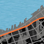
So let’s assume—as most everyone associated with the viaduct does—that the bulky, 49-year-old structure is about to meet its timely (or untimely) end. Suddenly, 120 feet of new right-of-way—the space, give or take 20 feet, once covered by the 60-foot-tall roadway—will be opened up and prime for redevelopment. What happens then? Do we start over from scratch, replacing the surface streets with open space, bike trails, and pedestrian- oriented kiosks and shops? Or do we make do the best we can with what we already have, adding a park here, a sculpture garden there, stitching together a viable quilt of businesses, transportation avenues, and open space one piece at a time?
Urban designers have spent months attempting to answer those questions. Even before the earthquake, members of Allied Arts were discussing what then seemed like little more than an interesting proposition: What if the viaduct wasn’t there? A Friday night gathering led to a series of fanciful sketches, which led to a full-fledged movement complete with its own fund-raising campaign and party in the shadow of the viaduct, dubbed “the Viaduct Wrecking Ball.”
But consensus on the future of the waterfront has been hard to come by. Allied Arts’ vision tends toward an urban, active streetscape with a balance of transportation corridors, entertainment, retail, and open space. City planners, meanwhile, have a whole series of plans—drawn up with the help of San Francisco architecture firm ROMA Design—that include one that would convert the entire area into open space; one that would turn the whole right-of-way over to walking paths, bikeways, and roads; and a couple of options in between.
Some of the ideas being circulated about the waterfront are fanciful, if feasible: a floating promenade along the waterfront or a skate park that converts into a swimming pool. “It should be urban and really encompass a whole series of activities, ranging from living to working to cultural activities—like the aquarium—to entertainment and restaurants,” Copeland says. A series of parks, Moon suggests, could serve as the links that tie the more urban aspects of the waterfront together. “I’d like to see one in Pioneer Square, one in the central waterfront, and the Olympic Sculpture Park and Myrtle Edwards at the north end.”
The consensus, such as it is, calls for a combination of urban “hardscape” and open space, with roads and pedestrian and bike trails limited to a relatively narrow strip of the waterfront landscape. Walkways would connect the ferry terminal at the south end of the central waterfront to a pierside amphitheater, shops, and sidewalk cafes, the new aquarium at Pier 59, and the Seattle Art Museum’s planned sculpture garden to the north, with another “destination” every block or so. “We like to think of it as a string of jewels,” says David Yeaworth, a board member of Allied Arts. Pedestrian connections coming downhill from the east would provide accessibility to streets like Pine and Virginia, which historically haven’t had much connection to the water.
On a practical level, everyone agrees that the waterfront’s relatively skinny sidewalks will be widened at least to 30 feet, possibly to 35, according to city planner Steve Pearce. Parking garages where the viaduct now stands are another almost certainty, because the parking that’s currently under the viaduct would be taken away.
Details such as how much open space should be required and how much pavement should be allowed remain key sticking points. But Boris Dramov, a principal at ROMA and the city’s lead design consultant on the waterfront, believes the number of parks matters less than the quality of the open space. Under ROMA’s scheme, open parkland would be balanced by a wide promenade—perhaps two walkways, one of them elevated—and accessibility. “It’s easy to say [let’s have] open space only, where only people with all the time in the world can hike to,” Dramov says. “People don’t go to places in urban areas for a total sense of isolation.” On the other hand, “if you overcrowd it with motion and traffic, they won’t go there, either.” That balance—bringing people to the waterfront while keeping the traffic and crowds manageable—is what Dramov and city planners are aiming for.
Many feel that more retail activity would draw visitors and locals year-round, especially if the new shops aren’t geared exclusively toward—however much the city needs them—tourists. “I think retail really activates a street and relates a street and its uses to the public,” Graff says. “As much as we can say the building Red Robin is in is kind of kitschy, it’s still a building I will occasionally walk through and experience. But does retail have to be all tourist retail? No, of course not.” Minimizing kitsch along the waterfront won’t be as easy as it sounds, however, because there’s no way to zone for taste: Tacky shops carry the same weight as tasteful sidewalk cafes or maritime museums in the eyes of city regulators.
Others are hopeful that if planners can create a place where Seattleites want to be, the tourists and their dollars will follow—as they have, to some extent, at Pike Place Market, a huge tourist draw that remains authentic enough to attract a healthy mix of locals and out-of-towners.
One hope is that the buildings that currently line the east side of the viaduct will, in time, “turn toward” the waterfront, becoming pedestrian-friendly shopping and dining destinations. Waterfront buildings, like others downtown, could be required to have pedestrian-oriented uses—shops, cafes, and restaurants—along the street level, with offices, apartments, or public housing above. In time, the eastern side of Alaskan Way could become, in Graff’s words, “one of the most fabulous walking experiences in Seattle.” But that will only be true if the businesses materialize—and with downtown commercial vacancy rates at staggering highs, many wonder whether there’s room for a new central retail strip. “I don’t think people come to the waterfront to shop,” says Argosy Cruises owner Blackman. “This area is never going to compete with the downtown core.”
Other cities that have undertaken similar projects provide both instructive and cautionary tales. When San Francisco’s Embarcadero Freeway collapsed during the 1989 Loma Prieta earthquake, the city turned the loss of its elevated, two-level waterfront roadway into an opportunity to redevelop its urban waterfront. Unlike Seattle’s viaduct, the Embarcadero was the terminus, not the heart, of a freeway, so tearing it down didn’t create the kind of uproar that simply shutting down the viaduct would spark here. But the comparisons are inevitable; the Embarcadero is the first thing most people mention when arguing for moving the viaduct underground. “San Francisco got rid of their freeway and the urban fabric was restored, and to my knowledge, it was magic,” Graff says. And it happened, if you believe people who gush about the city’s waterfront today, more or less organically—without major zoning restrictions or heavy-handed stage management from city planners. “I think just removing this monstrosity and replacing it with open space of whatever kind, even if it’s parking, is going to be such an improvement that I think the waterfront will be a place that people from Seattle will want to go [to],” Graff says. But complaints—about underutilized open space, vast expanses of empty pavement, and traffic along the surface street that replaced the freeway—are not uncommon.
The other project that always comes up is Boston’s “Big Dig,” believed to be the biggest public-works undertaking in U.S. history. The project, now estimated at just under $15 billion, involves burying and reconstructing two sections of the interstate highway that runs through the heart of the city, including a dangerous, rusting elevated section of I-93 that runs along the city’s waterfront. Known as the “Big Pig” by detractors, the project has suffered mismanagement, a fumbled cover-up of $2 billion in cost overruns, and an image as one of the most exorbitant road projects ever attempted. When completed, the project will include an eight-to-10-lane buried freeway, two new bridges, and acres of new parkland. It will cost nearly $2 billion a mile.
In general, people’s level of optimism about the viaduct fluctuates in proportion to their confidence in the big dreamers’ ability to implement their grandiose plans. For skeptics like Skolnik, the potential of the viaduct will inevitably be limited by history—the fact that our city and state governments have, time and again, been a reactive force to businesses’ plans for the waterfront. It wasn’t until after the Edgewater Hotel was built in 1962 that the city responded by rezoning the waterfront to prohibit—among other things—new high-rises, housing, and hotels over the water. View corridors extend along all the east-west streets leading to the central waterfront except Pike Street; but major developments, including a nine-story hotel and a proposed 200,000-square-foot aquarium in direct view of Victor Steinbrueck Park, were overturned only after infuriated citizens unleashed storms of protest. “Historically, the trend has been that things get proposed on the water and the city reacts to them,” Skolnik says.
That trend also, paradoxically, could limit the economic potential of the waterfront by restricting waterfront land uses to small businesses and cultural activities. “The economic value that might be achieved from properties adjacent to waterfront may not be there because the buildings are too small,” Skolnik says.
On the other hand, the optimists say the waterfront is primed for its long- delayed moment in the sun. The waterfront, Dramov believes, “is the easiest place to create public space, because it has intrinsic meaning to us. I don’t know if you want to call it religious or spiritual or what, but for some reason waterfront areas are something we are attracted to as people.” Create an expectation of the waterfront as a pleasant, attractive place to eat, shop, skate, or hang out and think, Dramov says, and pretty soon “you’ll have a great public space that’s meaningful to the city and the region as a whole.”