Prints make great gifts. But you won’t find some of the best prints for giving in any museum store or frame shop. To a connoisseur’s eye there’s nothing lovelier than a well-designed map—and nothing more useful, either. Maps combine the beauty of the severest painterly abstraction with a logic rooted in real life. Many of us learn to love maps when we discover a dog-eared family atlas. With age, roadmaps and newspaper maps rub some of the romance off the art form, but the right kind of map can still bring back the magic.
Seattle is remarkably well-supplied with cartographic outlets. Originally founded to produce real-state maps for the Puget Sound area Metsker’s Maps of Lakewood continues the mapping business, while two independent retail stores serve Seattle (701 First, 623-8747) and Tacoma (6249 Tacoma Mall Blvd, Tacoma, 253-474-6277) with maps of every description.
No other outlet has quite the breadth of Metsker’s, but some stores offer a notable selection in certain specialized areas. REI (222 Yale, 470-4020, with other stores in Federal Way, Lynnwood, and Bellevue) has a wide selection of USGS topographic quadrangles, the workhorse standbys upon which most other US maps are ultimately based, as well as other maps of special interest to hikers and campers. Wallingford’s Wide World Books and Maps (1911 N 45th, 634-3453) caters to the less strenuous traveler.
For cartographic gems farther off the beaten path, the World Wide Web provides terrific resources. Anyone with an Internet connection and a basic knowledge of how to use a Web search engine can quickly up turn up treasures. Many Western states issue wildly colorful geological, hydrological, and mineralogical maps of their terrain (check out New Mexico’s at http://geoinfo.nmt.edu/publications/geomaps.html for a sample). National parks, too, issue some remarkable poster-size products, like the curiously anatomic geological map of Grand Canyon you’ll find at the National Park Service “bookstore” site (http://www.grandcanyon.org/bookstore/).
Outside the US a lot of what you’ll find on the Web is on sites maintained by national governments and scientific institutions, which aren’t always terribly well set up for (or responsive to) requests for information and orders from individuals. But you’ll also find sites like Mapswap, a cartographic clearinghouse in the Netherlands that stocks an astonishing array of official government maps from every corner of the world. Interested in the route of the proposed Caspian Sea-Black Sea oil pipeline? Mapswap (http://www.mapswap.nl) can provide you with Russian, Iranian, Turkish military maps of the area. Need a roadmap of Libya? Al Fatah University of Tarabulus offers one not just of Khaddafi’s kingdom but neighboring bits of Chad and Niger, and with “different kinds of desserts ” clearly marked.
Land’s not the only area deserving of mapping. Some folks are lucky enough to possess a berth at Shilshole and something to tie up to it; other don’t own so much as a rowboat, but they too can dream, and thriftily, too: Feed their maritime dreams with charts of the Inside Passage (or the Sunda Straits) from Captain’s Nautical Supplies, 2500 15th W (one mile sound of the Ballard Bridge at Wheeler, 283-7242).
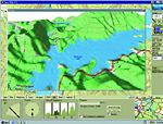
Slowly but surely new technology is coming to the map business as it has to other forms of publishing. One leader in the field is Delorme, of Yarmouth, Maine, proud owners of what the Guinness Book of Records says is the largest world globe in existence and publishers of the familiar large-format topographic road and hiking atlases of many American states. Just in time for Christmas Delorme has issued its most ambitious electronic product yet: a series of state-by-state CD-Rom packages featuring electronic versions of the USGS tope maps of the area, combined with the capacity to render any selected patch of same in stupefyingly impressive three-dimensional form, complete with the ability to rotate the landscape to any desired angle, raise and lower the observer’s point of view, and zoom in closer and closer for details.
Such visual pyrotechnics make great demands of a computer’s CPU, and on older machines (with processors slower than 266mHz, say) the display of a single frame is slow enough to make even patient people tap their fingers while the screen sits frozen. But for the map-addicted, the Delorme boxes provide cheap thrills now (listing at $129—twice that bor big states like California—most are available at heavy discount for the holidays) and the promise of wonders to come as computers get ever faster. And for now, there are still basics that every home should have: basics like the Times Atlas of the World ($250, currently on sale at University Book Store at $212): a book so sumptuously big and heavy that the only proper way to read it is flat on your tummy in front of the fireplace.
Roger Downey is a senior editor at Seattle Weekly.